Chuuk International Airport | Kosrae International Airport | Fais | Houk (Pulusuk) | Mortlock Islands (Ta) | Mwoakilloa Atoll | Onoun (Ulul) | Pingelap Atoll | Pohnpei International Airport | Sapwuahfik Atoll | Ulithi | Woleai | Yap International Airport
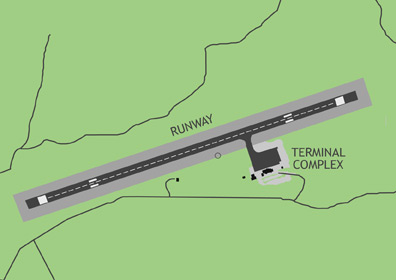
Yap International Airport is located in the southern part of the Yap Islands, also called Wa'ab, a group for four continental islands connected by a single reef. The airport receives regular commercial flights from Guam and Palau. Pacific Missionary Aviation makes periodic trips to the outer island airfields of Ulithi & Fais. Woleai Airfield is currently closed for repairs.
ABOUT THE YAP ISLANDS
Wa'ab is a rugged land of rolling hills and mangrove forests. The capital and major population center is Colonia Town. Also part of Yap State are a collection of outer atolls, some as far as 500 miles from Colonia. The state has a total land area of 39 square miles and supports just over 11,000 people, who speak a variety of dialects related to the Malay languages of Southeast Asia. Yap is most famous for its thriving traditional culture, giant stone money called rai, and graceful manta ray populations. The atoll-dwellers of Yap were some of the most celebrated oceanic navigators in the Pacific, sailing vast distances in their outrigger canoes with only the stars and wave patterns to guide them.
BASIC INFORMATION
| FAA Identifier: | T11 |
| Lat/Long: | 09-29-56.0820N / 138-04-56.9860E 09-29.934700N / 138-04.949767E 9.4989117 / 138.0824961 (estimated) |
| Elevation: | 91 ft. / 27.7 m (surveyed) |
| Variation: | 01E (1990) |
| From Population Center: | 3.5 miles / 5.6 km SW of of COLONIA TOWN, WA'AB |
| Time Zone: | UTC +10 (year round; does not observe DST) |
AIRPORT OPERATIONS
| Airport Use: | Open to the public, A018 PPR FOR LANDING TO BE FILED 48 HR IN ADVANCE WITH FSM SECRETARY OF TRANSPORTATION, COMMUNICATION & INFRASTRUCTURE. |
| Activation Date: | 11/1983 |
| Sectional Chart: | GNC 13 |
| Control Tower: | no |
| ARTCC: | HONOLULU CONTROL FACILITY CENTER |
| FSS: | HONOLULU FLIGHT SERVICE STATION |
| NOTAMs Facility: | PTYA (NOTAM-D service available) |
| Wind Indicator: | yes |
| Segmented Circle: | yes |
| Lights: | RDO-CTL ACTVT MIRL; VASIS & REILS RWY 07/25 - 123.6. |
| Beacon: | white-green (lighted land airport) |
| International Operations: | international airport of entry |
AIRPORT COMMUNICATIONS
| CTAF: | 123.6 (COMS provided by Yap Radio) |
AIRPORT SERVICES
| Fuel Available: | A1 |
| Airframe Service: | no |
| Powerplant Service: | no |
| Bottled Oxygen: | no |
| Bulk Oxygen: | no |
RUNWAY 7 / 25 INFORMATION
| Dimensions: | 6000 x 150 ft. / 1829 x 46 m | |||||||
| Surface: | asphalt/grooved, in good condition | |||||||
| Weight Bearing Capacity: |
|
|||||||
| Runway Edge Lights: | medium intensity | |||||||
| RUNWAY 7 | RUNWAY 25 | |||||||
| Latitude: | 09-29.778633N | 09-30.090750N | ||||||
| Longitude: | 138-04.475500E | 138-05.424050E | ||||||
| Elevation: | 90.5 ft. | 89.4 ft. | ||||||
| Traffic Pattern: | left | left | ||||||
| Runway Heading: | 071 magnetic, 072 true | 251 magnetic, 252 true | ||||||
| Markings: | nonprecision, in fair condition | nonprecision, in fair condition | ||||||
| Visual Slope Indicator: | 4-light PAPI on left (3.00 degrees glide path) | 4-light PAPI on left (3.00 degrees glide path) | ||||||
| Runway End Identifier Lights: | yes | yes | ||||||
| Touchdown Point: | yes, no lights | yes, no lights | ||||||
| Obstructions: | 6 ft. gnd, 404 ft. from runway, 34:1 slope to clear | 29 ft. gnd, 1200 ft. from runway, 300 ft. left of centerline, 34:1 slope to clear |